
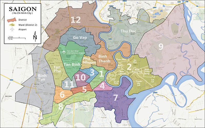
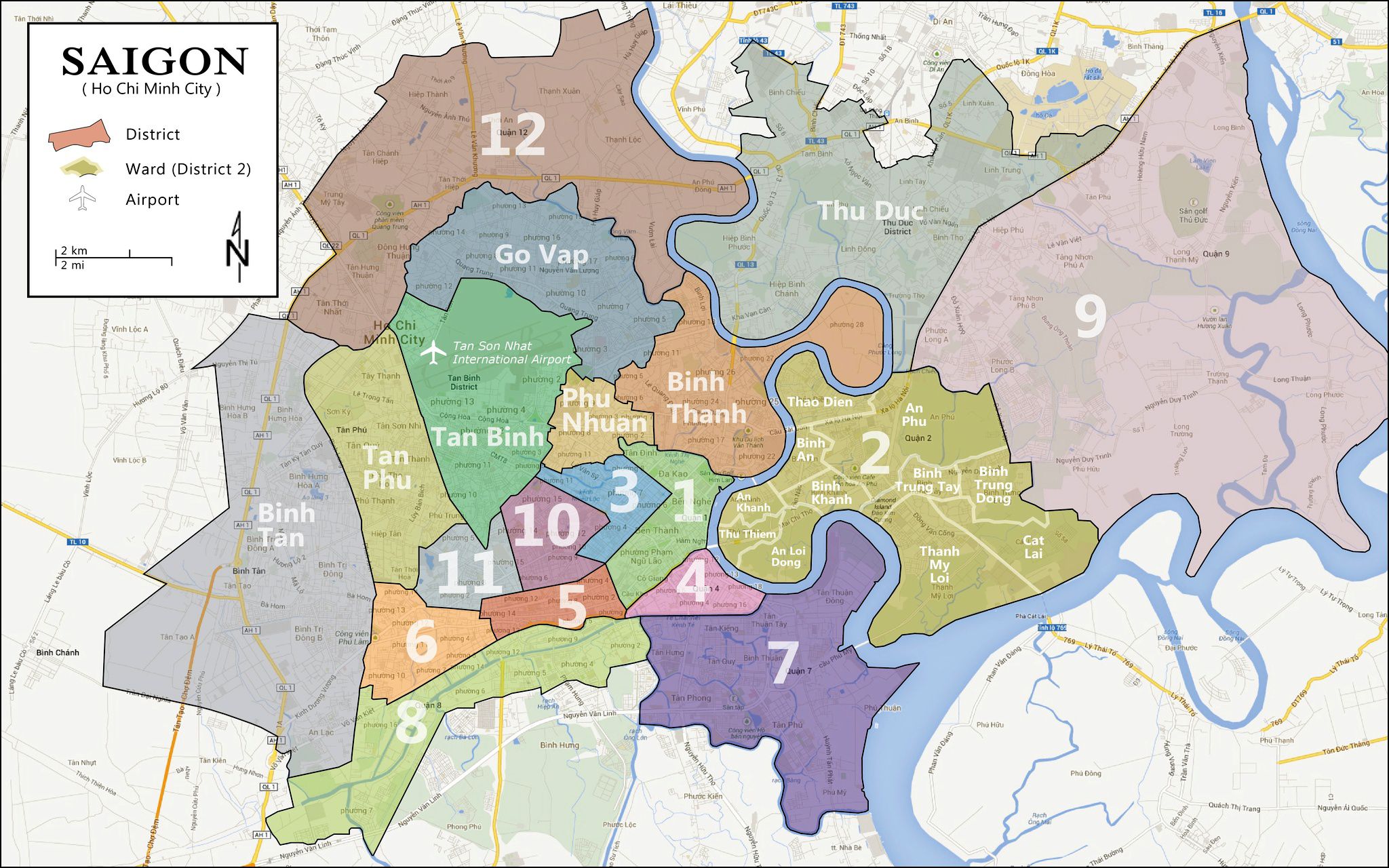
This is a simple and good map of Ho Chi Minh City ( Saigon ) if compare it with other maps on the internet. The core is here each urban district separated by the bold line makes the map easier to use. Another way it only shows us the main districts, main streets and buzz words. This simple Saigon’s map district suitable for Expat using to travel or searching home in Ho Chi Minh city.
Saigon has 24 districts and divided on a total 2000 square kilometer, base on convenient natural conditions this city become an important transport commercial hub and cultural center of Vietnam and Asia. Ho Chi Minh City is the heart of Vietnam southern, which is the largest and most populated city.
Contents
Guide to District 1 – Overview map and understanding
District 1 is the commercial core and business hub of Ho Chi Minh City, Vietnam. This is considered the prime location and highest standard living throughout 19 urban districts and 5 sub-districts. Daily expensive lifestyle happened on every corner, there have the best culturally in this city. District 1 has 6-kilometer length distant with Tan Son Nhat airport in Tan Binh district, this also a place to go for international cuisine, consulates, banks, government departments and administrative buildings,…
Guide to District 3 – Google map view and description
District 3 is an urban district of Ho Chi Minh City, Vietnam. District 3 has many French colonial villas, an urban district with high greenery density. Moreover, it has a lot of famous destinations such as Saigon railway station, Vinh Nghiem Pagoda, Xa Loi temple. District 3 along with 7 other districts of Saigon City was established on May 27, 1959. In a little more detail, district 3 has many main streets in Ho Chi Minh City such as Nam Ky Khoi Nghia, Hai Ba Trung, Cach Mang Thang 8, Vo Thi Sau, Vo Van Tan, Ly Chinh Thang, Nguyen Dinh Chieu, Ba Huyen Thanh Quan, Dien Bien Phu,… Besides, Nam Ky Khoi Nghia Street in District 3 is the main street to connect The airport with District 1.
Guide to District 2 – Thao Dien and An Phu area
District 2 located in the Eastern of Ho Chi Minh City. That has 11 wards included the Thao Dien area and An Phu – An Khanh ward. At the north meet with Thu Duc district and comeback Binh Thanh district and city center by Saigon Bridge. District 2 has many main streets such as: Hanoi high-way, Nguyen Van Huong street, Mai Chi Tho street,… Currently, besides the Thao Dien area and An Phu – An Khanh, District has been forming many new urban areas such as: Thu Thiem City, Sala City, Lake View City,…